
You may keep up to 25 pounds of rocks, mineral specimens, and invertebrate fossils per person per year from eligible Michigan DNR and public-trust land for hobby use. Michigan rockhounding rules set one combined annual limit, but ownership and federal boundaries can change where collecting is allowed.
The ordinary high-water mark (OHWM) is the boundary used to identify the public-trust strip along Great Lakes shores. That line can be hard to spot during a shoreline hunt, especially where a beach stretches above the water’s edge. The exact parcel matters as much as the specimen you hope to find.
You can avoid a costly mistake by checking the land manager before collecting. This guide explains how the allowance works and what to confirm before you take a natural find. Check who manages the exact stretch of shore before you put a find in your bag.
How Michigan Rockhounding Rules Set the 25-Pound Limit
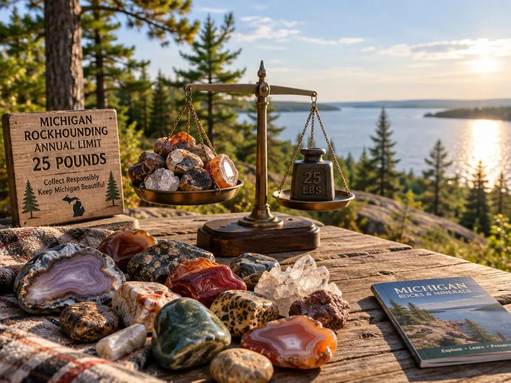
A pocketful from one park and a later beach haul both draw from the same yearly 25-pound total. The allowance covers individual, non-commercial rock collecting on eligible DNR land, and no permit is required while you stay within it.
The annual limit is 25 pounds per person for rocks, mineral specimens, and invertebrate fossils combined. It is not 25 pounds of each material, and it does not restart when you visit another location.
For example, imagine you take 8 pounds of stones from one state park. Later, you collect 6 pounds of rocks and fossils at another eligible DNR location. Those finds add up to 14 pounds of your yearly allowance, leaving 11 pounds for the rest of the year.
The same total applies across DNR locations rather than separately to each park. That makes your own trip records useful, especially if you collect on several weekends or share a vehicle with other rockhounds. The allowance is per person, so keep your finds separate from another collector’s.
Hobby collecting means you keep specimens for personal enjoyment rather than selling them or using them in a commercial operation. Material collected for commercial use is treated differently, and the ordinary allowance does not cover gold-bearing material.
Weight can be hard to judge on a beach, where wet stones may feel heavier than they look. Use a scale at home to check a representative load, then record a reasonable estimate for each outing. Keep a running weight estimate for the whole year rather than resetting it at each new location.
Which State Lands Allow Hobby Collecting?
A state park, recreation area, or state forest is covered by the same DNR hobby-collecting allowance. These state lands share one rule for personal collecting, with no permit required when you stay within the allowance.
The DNR allowance applies to state parks, recreation areas, and state forests. A location’s name alone does not establish who manages it, so distinguish DNR property from a city, county, or federal park.
State parks, recreation areas, and state forests
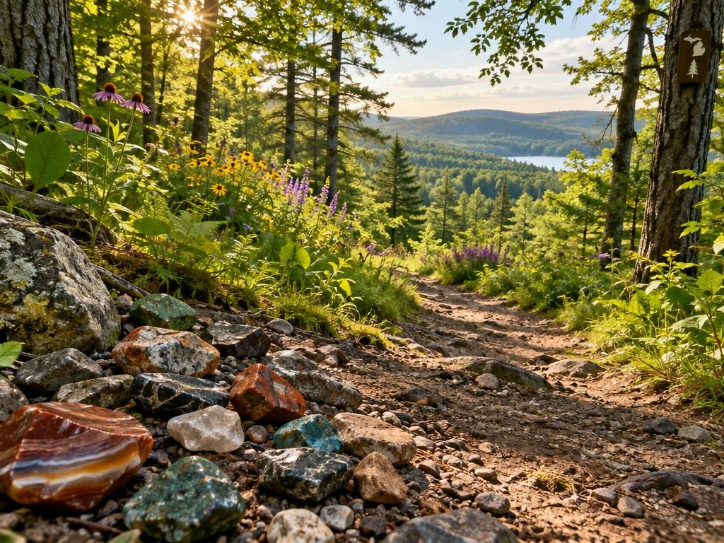
At a DNR-managed state park, you may collect eligible natural specimens for your hobby. The same applies at a state recreation area or state forest. Rocks and minerals can appear along trails, exposed ground, and shorelines, but the land manager still determines which rule applies.
A public sign or recreation map may help identify a site, but it does not always show the boundary of a specific parcel. If a trail crosses between public properties, the collecting rule can change before the scenery does.
The combined DNR land allowance
Moving from one state property to another does not give you a fresh allowance. Rocks, mineral specimens, and invertebrate fossils all count toward the same combined annual total across DNR land. Keep track of what you collect even when each individual stop produces only a few small stones.
The Michigan Geological Survey’s MGS Rockhounds collecting guidance describes the combined personal-use limit for state land and Great Lakes shorelines below the OHWM. Its map can help you explore areas of geological interest, but it cannot confirm the manager of every parcel.
Before you start, check the property listing or contact the office responsible for the site. Confirm that the property is actually managed by the DNR, not simply described as a public park.
Where Does Public-Trust Shoreline Collecting Apply?
On Great Lakes shores, the public-trust collecting area is below the ordinary high-water mark, not automatically the entire beach. The 25-pound allowance applies to that public-trust strip, where the boundary can be subtle.
The OHWM generally lies near the current water level and usually does not reach the top of a beach. Its position can shift with water levels and shoreline conditions, so a dry stretch of sand may not be part of the public-trust area.
A beach may include land with more than one owner or manager. The public-trust strip below the OHWM is distinct from the upper beach, which could be private property or managed by a park or another agency.
Water levels affect the visible shoreline, but they do not turn every area reached by waves into a public collecting zone. A steep beach, a wide sandy slope, and a rocky ledge can each make the boundary difficult to judge in the field.
Public access to walk along a shore in front of private property does not itself give you permission to remove stones. Access and collecting are separate questions. Check the manager and rules for the specific area before taking a natural find.
On a beach with no clear boundary marker, do not use the water’s edge or the top of the sand as a substitute for checking ownership. Treat the dry upper beach as separately managed until you verify its ownership.
What Changes on Private, Commercial Forest, and Local Park Land?
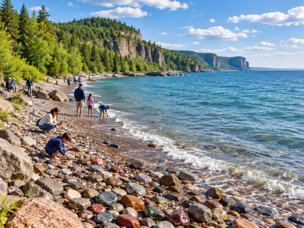
A public trail or park entrance does not guarantee that you may take rocks from the ground there. Permission depends on the landowner and the rules of the agency or local government managing the site.
You need the landowner’s permission to collect on private property. Public access, a marked trail, or a place to park does not grant the right to remove stones.
Michigan Commercial Forest land also requires the owner’s permission for rock collection. Those lands may be open for certain public uses, but that access does not include taking rocks without approval. Contact the owner before planning a collecting trip.
Township and city park rules depend on local ordinances, so do not assume that every municipal or county park allows collecting. Some parks permit ordinary recreation while banning the removal of natural material.
Grant Township’s Hunter’s Point Park in Copper Harbor prohibits removing rocks or stones. That local rule is a useful reminder that a scenic public beach can have a stricter rule than the statewide DNR allowance.
The Mackinac Island State Park Commission’s rules do not set a rock-collection rule. Contact the Commission directly to ask whether the DNR limit applies to the specific property you plan to visit. A park’s state affiliation alone does not settle the question.
When a sign or park page does not clearly address collecting, ask the office that manages the parcel rather than relying on another park’s policy. Get the owner’s permission before collecting from Commercial Forest land or any private parcel.
Federal Sites Where Rocks Must Stay
A legal state shoreline hunt can become prohibited as soon as you cross into a national lakeshore or park. Federal boundaries matter, and the state allowance does not override federal restrictions.
Do not remove rocks from federal sites where collecting is prohibited. Park boundaries can meet land where hobby collecting is allowed, making a map check essential before you pick up a specimen.
National lakeshores and Isle Royale
Collecting beach stones is prohibited inside Pictured Rocks National Lakeshore. Removing stones from Sleeping Bear Dunes National Lakeshore is illegal under federal law. These national lakeshore rules apply even when the same kind of stone can be collected legally on eligible state land nearby.
Collecting chlorastrolite is illegal in Isle Royale National Park. The rule is especially important for anyone looking for the green mineral known as Isle Royale Greenstone. Do not take it from the park, even if you find a loose piece.
National Park Service collecting restrictions under 36 CFR 2.1 can carry federal penalties of up to $5,000 and six months. That is a separate consequence from state land-use rules. A specimen’s small size does not make removal permissible.
Keweenaw National Historical Park parcels
Keweenaw National Historical Park includes federally owned parcels where collecting rocks or minerals requires a research permit. The park’s boundary can include separate parcels, so the name of a nearby town or trail does not tell you which land manager controls a spot.
A research permit is not the same as ordinary hobby permission. If you are not collecting under the required permit, leave specimens in place on federally owned parcels. Check the parcel boundary before stopping to collect along a road or trail.
Whitefish Point and Seney National Wildlife Refuge
Rock and driftwood collection is prohibited at the Whitefish Point Unit of Seney National Wildlife Refuge. The restriction covers driftwood as well as stones, so do not assume that an object on the beach is available to take.
At places where a legal shoreline hunt meets protected land, the boundary may not be obvious from the beach. Look for posted signs and confirm the parcel on a current map before beginning. Turn back from collecting when a posted federal boundary or refuge restriction begins.
When Do Collecting Permits Apply?
A recreational rock bag is different from a commercial collecting operation or a gold-prospecting trip. The activity matters: commercial use and gold-bearing material fall outside the ordinary hobby allowance.
Commercial rock collecting on Michigan state land requires a DNR permit. Personal hobby collecting does not authorize you to gather specimens for sale or other commercial use.
The 25-pound hobby allowance excludes gold-bearing material. Gold panning and sluicing are closed on Great Lakes shores and bottomlands, so a state shoreline is not a place to prospect for gold under the hobby rule.
Amateur gold prospecting on Michigan state land outside Great Lakes shores and bottomlands requires an EGLE permit. This is a different activity and permit path from collecting ordinary rocks for personal enjoyment.
Keep the location distinction clear. A prospecting plan on a river or inland state parcel may raise different requirements from a trip to a Great Lakes beach, where recreational gold panning and sluicing are closed.
Do not treat a permit for one activity as permission for another. Commercial rock collecting and amateur gold prospecting are separate cases, with different agencies and conditions to check.
Before taking prospecting gear to a state parcel away from the Great Lakes, describe the location and planned activity when you contact the agency. Ask EGLE which permit applies before prospecting on state land away from the Great Lakes.
Penalties and Protected Historical Finds
Exceeding Michigan’s DNR land-use rules can lead to a state civil infraction and a fine. Natural finds and historical material are not treated alike, even when both appear loose on the ground.
A DNR land-use violation is a state civil infraction, with a civil fine of up to $500. That state penalty is separate from federal consequences for violations at protected sites.
State land-use violations
Take care to follow the rules that apply to the property, not just the weight allowance. A permitted amount of rock collecting does not create permission to remove other protected material or to ignore a site-specific restriction.
Historical objects, including relics and artifacts, are protected state-land antiquities. A metal object, worked stone, or unusual fragment may have cultural meaning that is not obvious at first glance.
Relics and bottomlands finds
Great Lakes bottomlands are state-owned. Natural rocks are not the same as relics or artifacts, and an old object found underwater or along bottomlands may fall under separate reporting requirements.
Abandoned property worth more than $10 and abandoned for more than 30 years must be reported in writing within 30 days when found on Great Lakes bottomlands. Do not assume that a valuable or historic-looking item is an ordinary collectible.
If a find appears worked, unusually old, or connected to human activity, leave it where it lies. Avoid cleaning or moving it, since the setting can help show what it is and where it came from.
Report a qualifying bottomlands find through the appropriate state channel rather than taking it home. Leave a worked artifact or suspected relic in place and report it through the appropriate state channel.
Check Land Status Before You Start
Before setting out, identify the land manager for the exact trail, beach, or parcel you plan to visit. Start with the boundary, then check access rules and any permit requirement for collecting.
Land status determines which collecting rules apply. A useful checklist includes the parcel owner or manager, current signs, and any rules for removing rocks or minerals.
USDA-administered national forests and recreation areas allow a small reasonable amount of rock and mineral collection for personal use. Some signs indicate about 10 lbs. Collecting stones and minerals may require a free-use permit, so check with a local ranger station.
Read the signs at the site, since a general rule may not cover a specific trail or area. A ranger station can tell you whether a free-use permit applies and how much personal collecting is considered reasonable there.
Michigan state parks require a Recreation Passport to drive into the park. The passport covers vehicle entry, not permission to collect. Keep those two questions separate when planning a trip.
Michigan Rockhounds communities can help identify a specimen or suggest geology topics to explore. They cannot grant collecting permission or determine a property boundary, so use the land manager for those decisions.
Save a park or agency phone number with the trip details on your phone. If you receive a permit confirmation, keep it with the same notes so you can find it at the site. Save the manager’s contact details and any permit confirmation with your trip notes.
Planning and collection records: A weatherproof notebook helps record the land manager and your finds; a small scale and carry bag help keep a personal collection organized.




Petoskey Stones: Fossil Corals Across Michigan
A Petoskey stone is a fossil coral, not a modern beach pebble with a coral-like design. Its pattern comes from fossil structure, and the familiar name does not determine whether you may collect one at a given beach.
Petoskey stones are fossil corals in the genus Hexagonaria from the Devonian Period, about 350 million years ago. Their visible pattern reflects the structure of the ancient coral.
What a Petoskey stone is
The fossil formed long before Michigan’s present lakeshore existed. Once exposed and worn by weather, a piece can show the repeated shapes that make Petoskey stones recognizable to collectors.
A fossil’s pattern can become easier to see when its surface is wet, but appearance alone does not settle every identification. Some fragments show only part of the coral structure, while others have a clear, repeating pattern.
Where Petoskey stones have been found
Petoskey stones have been found at public beaches from Frankfort to Fort Gratiot County Park. The range gives collectors a broad sense of where the fossils occur, not blanket permission to remove them from every beach.
They have also been found inland in Michigan sand and gravel mines. Mine access and collecting rules depend on the site and its manager, so do not enter or collect without permission.
Public access can also come with limits on what you may take. A beach may be locally managed, privately owned above the shoreline, or part of a protected federal site.
Before heading out, identify the current manager for the exact stretch of shore you have in mind. Treat a familiar Petoskey-stone beach as a collecting option only after checking its current manager and rules.
Glacial Erratics to Recognize
Many of Michigan’s unusual loose stones arrived as cargo carried south by the Laurentide Ice Sheet. Glacial erratics are rocks transported and deposited by glaciers, including stones that traveled from Canada.
As the Laurentide Ice Sheet retreated, it left transported rocks across Michigan. Their varied appearance reflects the places and rock types caught up in the moving ice.
Glacial erratics may sit far from the bedrock where they formed. A stone found on a beach or in a field can therefore have a different geological origin from the ground beneath it.
Puddingstones and lightning stones
Michigan puddingstone is a quartzite conglomerate with bright red jasper inclusions. Its contrasting pieces are set within a harder surrounding rock, giving the stone a distinctive speckled appearance.
Lightning stones were formerly known as septarian nodules. The older name remains familiar to some collectors, but lightning stone is the term used here for the specimen.
These names help you describe a find, but a quick look may not confirm its identity. Compare the stone’s texture and visible parts before deciding what you have.
Chlorastrolite and Michigan’s state gem
Chlorastrolite, also called Isle Royale Greenstone, is Michigan’s official state gem. Its name is strongly tied to the island, but it is not a collectible to take from Isle Royale National Park.
Collecting chlorastrolite is illegal in Isle Royale National Park. A specimen’s status as the state gem does not create an exception to park restrictions, and a loose stone inside the park must remain there.
Knowing a stone’s name can make a geology walk more rewarding, but location still controls what you may keep. Use the name of a specimen to guide identification, not as proof that collecting is allowed.
Finding Yooperlites Legally
A Yooperlite’s sodalite-bearing material fluoresces under a black light, making it easier to spot after dark. The glow is a clue, not permission to collect wherever the stone appears.
Yooperlites are sodalite-bearing glacial erratics that fluoresce under a black light. Glaciers carried the rocks from the Coldwell Alkaline Complex near Marathon, Ontario, to Michigan’s Lake Superior shore.
How Yooperlites fluoresce
Sodalite in the rock responds to ultraviolet light, creating a visible glow under a black light. That effect can help you distinguish a Yooperlite from other stones along a dark shoreline.
The rocks’ journey is part of Michigan’s glacial story. Their presence along Lake Superior reflects transport from Ontario, rather than formation at the beach where you find them.
Where collection is allowed
Michigan allows Yooperlite collecting on state land within the annual limit. Collection is prohibited at Whitefish Point and Pictured Rocks National Lakeshore, where site restrictions override the state allowance.
Before a night search, identify the land manager for the beach and confirm that collecting is allowed there. A glowing stone on a protected stretch stays in place, even if it is easy to spot.
Darkness can make signs and property boundaries harder to see. Check the location while there is still daylight, especially where public shoreline meets a national lakeshore or refuge boundary.
For the state-specific Yooperlite rule, see the Yooperlite collecting restrictions. Check the exact beach boundary before using a black light or collecting a glowing stone.
Lake Superior Agates and Collecting Areas
Lake Superior agates are mainly chalcedony, a variety of quartz, and are among Michigan rockhounds’ sought-after shoreline finds. Their banded appearance makes them popular, but a named beach is not automatically open to collecting.
Lake Superior agates are sought after for their bands and varied appearance. Whether you may keep one depends on the rules for the land where you find it.
What distinguishes a Lake Superior agate
Collectors look for agates along the Lake Superior shore, where stones can turn up among other beach material. A beach find may be an agate, but identification and collecting permission are separate questions.
The shoreline itself changes from one stretch to another. A public access point can lead to land managed by a state park, a local agency, or another owner, with different rules for removing stones.
Shoreline locations to check
Muskallonge Lake State Park is a Lake Superior shoreline destination enjoyed by rock collectors, especially agate collectors. Its popularity makes it a natural place to investigate when planning a hunt.
Do not treat the park’s reputation as automatic permission to collect. Check its current access and collecting rules before you go, and account for any finds in your annual total.
Conditions and posted rules can change, and a familiar collecting spot may include more than one management boundary. Confirm the rules for the area you intend to walk rather than relying on a nearby beach’s policy.
Use the park’s current information to plan your route and access. Check the park’s current access and collecting rules before planning an agate hunt.
Maps and Regional Access Around Michigan
A geology map can narrow your search area, but it cannot tell you by itself whether you may remove a rock there. Use maps as a starting point, then check property boundaries and access.
Surficial geology maps show landforms that can help you look for glacial erratics. Moraines and other glacial features may concentrate transported rocks, but they do not establish collecting permission.
Use geology maps to narrow a search area
A Lake Superior rock hunting map can help you compare geology and locate areas worth researching. A map of surficial deposits may show moraines and other features shaped by glaciers, giving you a practical way to shortlist a region.
Match each promising map area to a land manager before planning a stop. Geological interest does not mean public access, and public access does not necessarily allow collecting.
Check access near Munising and Port Huron
Bay Furnace Beach in Munising has been named as an agate-collecting area, making it a regional place to investigate. Check its current manager and rules before treating it as a collecting destination.
For rockhounding in Port Huron, Michigan, begin with the land manager and local-park rules for each beach. Known Petoskey-stone localities extend from Frankfort to Fort Gratiot County Park, but the range does not make every stop open to collecting.
Some beaches sit near protected land or have local restrictions that are not clear from a geology map. Keep access research separate from geology research so an attractive map pin does not become an assumed collecting spot.
Confirm the exact site before leaving home, especially when a route includes several beaches. Match every map pin to a land manager and current posted rules before heading out.
Identify Beach Rocks by Visible Clues
A banded stone is not automatically an agate; translucence is one useful clue to check. Look at several traits rather than making a decision from one pattern or a beach name.
Lake Superior agates may show translucence, banding, a waxy luster, and sometimes a pockmarked surface. No single clue confirms an identification on its own.
Hold a stone toward natural light to see whether light passes through its edges. Then look for curved or layered bands and note whether the surface has a waxy shine or small pits.
Banded jasper and hematite can resemble an agate, as can laminated sandstone. Those lookalikes are not translucent, so the way light passes through a stone can help distinguish them from a true agate.
A Lake Superior rock identification chart can help you compare common features, but a chart cannot settle every specimen. A Lake Huron rock identification chart also needs several visible traits, since the beach name alone does not identify a stone.
Photographs can help you compare a find with a reference later. Use natural light and include enough detail to show both the surface and the stone’s edges.
When a rock has mixed or unclear features, describe what you can see instead of settling too quickly on a name. Photograph both sides in natural light before relying on a single visual feature.
Field identification: Use field guides and a loupe to compare visible features; confirm collecting permission separately for each location.


Clean and Handle Finds Without Damage
A harsh soak can damage a fossil’s surface even when it seems like an easy way to bring out its pattern. Start gently, especially when you do not know the specimen’s mineral makeup.
Water and a soft brush are less aggressive choices for cleaning a specimen. Household vinegar contains acetic acid, which can etch calcite-bearing fossil material.
Petoskey stones are fossil corals, so soaking one in vinegar is unnecessary and potentially damaging. Calcite reacts with acids, and vinegar’s acid can leave an etched surface instead of improving the fossil’s detail.
Rinse a legal find with water and use a soft brush to loosen dirt. Avoid strong cleaners, scraping tools, and long soaks when you cannot identify the material with confidence.
Some rocks tolerate cleaning methods that would harm a fossil or a softer mineral. If you are unsure what a specimen contains, keep the treatment mild and stop if the surface changes.
Handle fragile pieces with care while they are wet, since loose grains or worn edges may be easier to damage. Let the stone dry naturally rather than applying heat or chemicals.
For a specimen whose material is understood, try a new method on a small, less visible area first. Test any cleaning method on an inconspicuous spot only when the specimen’s material is understood.
Gentle cleaning and storage: A small brush, clean cloths and a display case can help you clean and store permitted finds gently.


Conclusion
A legal Michigan rock hunt starts by checking the land, not by choosing a favorite stone. The manager and boundary determine whether you may keep a find, and the DNR and public-trust allowance is one combined annual total.
Before your trip, identify the exact parcel, read its current rules, and bring a way to track collected weight. A small scale or written estimate can help you keep a useful record across outings.
Before your next outing, confirm the boundary and permission for your specific destination.


 Love Rock Tumbling?

Have a question? Use the form above to submit your question or comment.
I love hearing from you and seeing what you made!